清迈雨季与洪水:月份、风险与预警
5月到10月要按有雨来准备,8月雨最多,约223毫米。遇上坏年份,湄平河会淹进城里:2024年纳瓦拉桥(Nawarat Bridge)的水位到过创纪录的5.12米。防洪堤外的低洼地带最先进水,所以先拿你所在的街道对照分区表,再存好DDPM热线1784。
阅读英文版 (Read this guide in English)
5月到10月都要按有雨来准备,租房或订房之前先查清你所在街道属于哪个洪水区。雨最多的是8月,清迈这时降雨约223毫米;遇上坏年份,湄平河会淹进城里:2024年纳瓦拉桥的河水高出河岸1.23米。下面会讲哪几个月多雨、河水涨到哪个水位时哪些区域进水,以及该打给谁。
逐月雨季
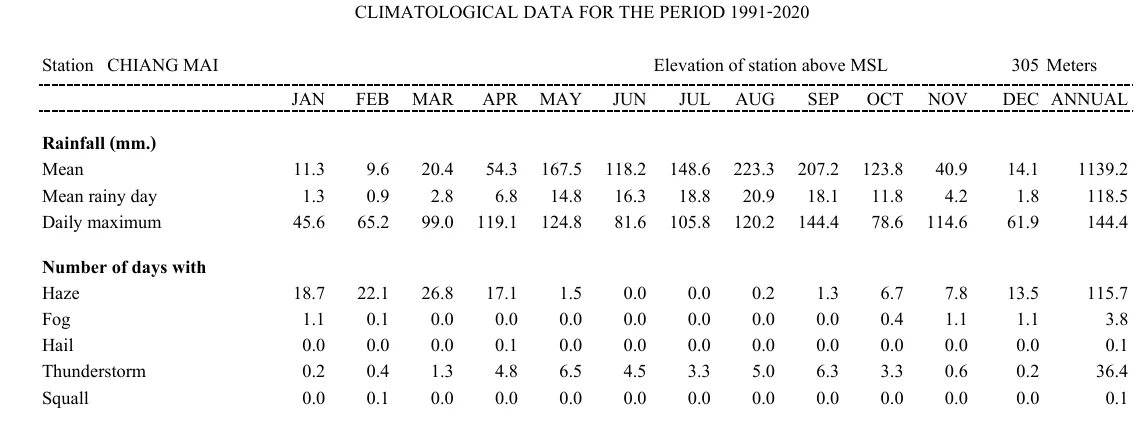
5月到10月要按有雨来准备,这几个月平均降雨都在118.2毫米以上。表中只要降雨达到0.1毫米就算一个雨天,这些数字是清迈市的长期平均值。
| 月份 | 降雨(毫米) | 雨天 | 雷暴天 |
|---|---|---|---|
| 1月 | 11.3 | 1.3 | 0.2 |
| 2月 | 9.6 | 0.9 | 0.4 |
| 3月 | 20.4 | 2.8 | 1.3 |
| 4月 | 54.3 | 6.8 | 4.8 |
| 5月 | 167.5 | 14.8 | 6.5 |
| 6月 | 118.2 | 16.3 | 4.5 |
| 7月 | 148.6 | 18.8 | 3.3 |
| 8月 | 223.3 | 20.9 | 5.0 |
| 9月 | 207.2 | 18.1 | 6.3 |
| 10月 | 123.8 | 11.8 | 3.3 |
| 11月 | 40.9 | 4.2 | 0.6 |
| 12月 | 14.1 | 1.8 | 0.2 |
8月和9月雨最多,手册里有记录的单日最大降雨出现在9月。如果你赶在3月来,问题就不是水,而是烟:可以读一读清迈烧荒季指南。
2024年洪水淹了哪里
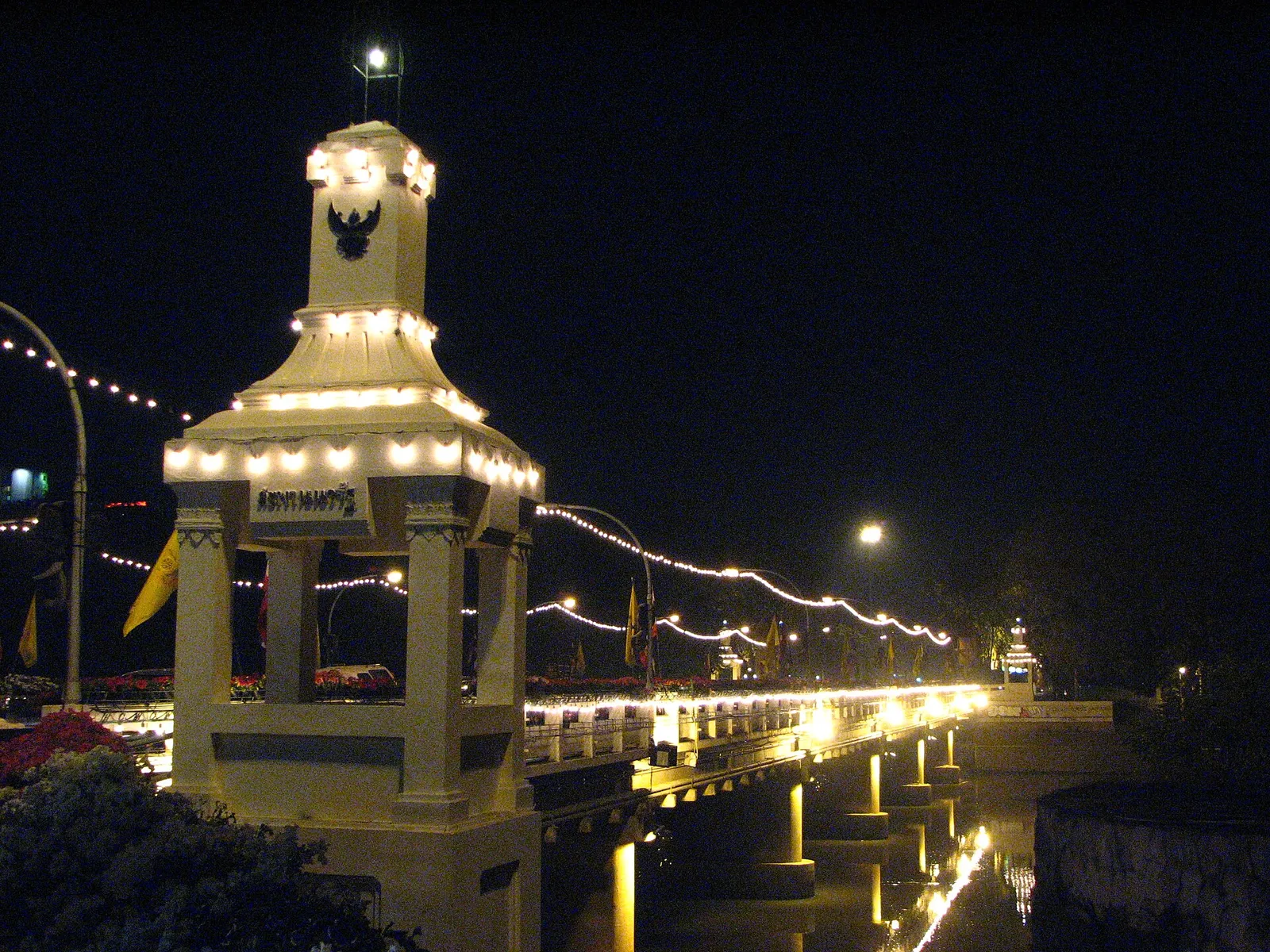
2024年的洪水来了两轮,第一轮在9月26日于纳瓦拉桥达到最高,水位+4.93米。第二轮超过它,10月4日创下5.12米的纪录,之后市政部门报告的5.28米已进入红色警戒区间。
商业区很多地方水深约1米,是50年来最严重的一次。Chang Khlan Road和夜市一带超过1米,部分游客被转移出去。Arcade客运站被淹,游客被困,去机场的Mahidol Road在Pa Phrao Nok附近路段被淹,铁路也因水流湍急而停运。航班照常运行,灌溉部门预计水位大约五天后回落。
如果遇上洪水,实际可走的路线写在清迈巴士和火车站和清迈机场到市区两篇里。
河水到哪个水位,哪些区域会进水
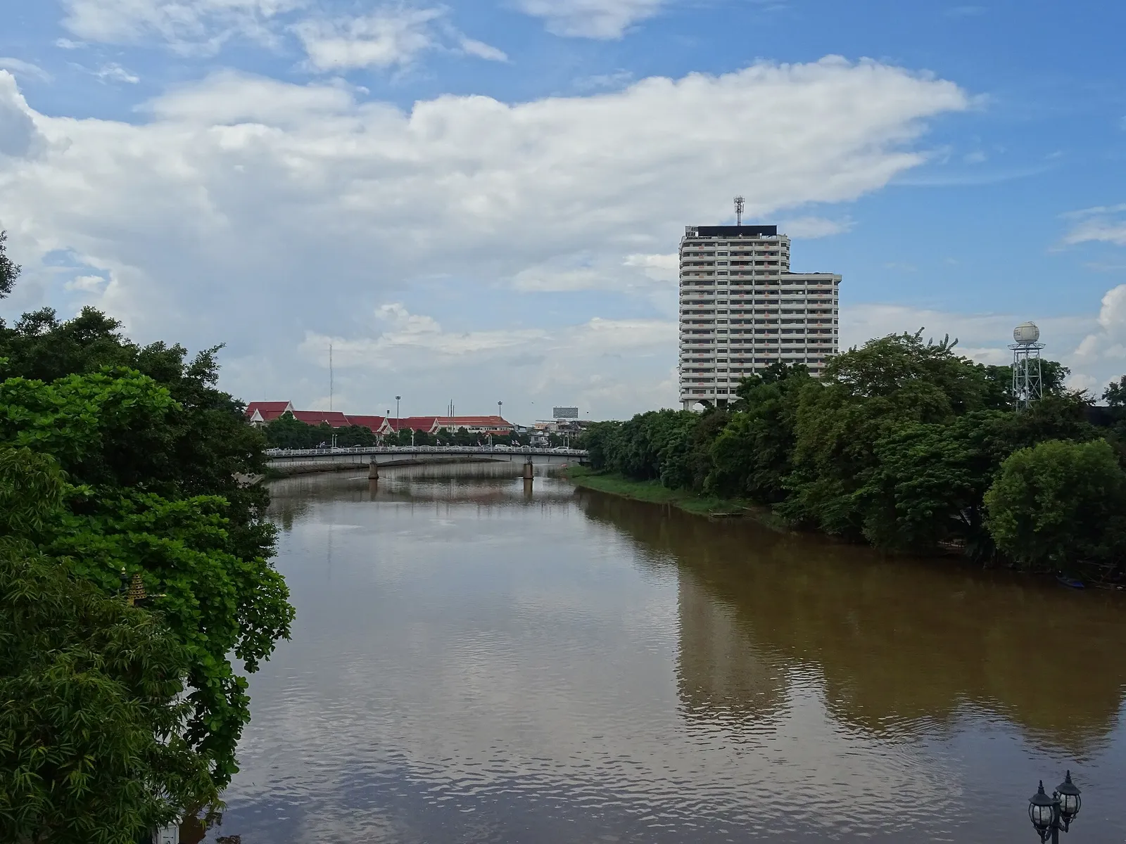
在下表中找到你所在的街道,再和纳瓦拉桥水文站的读数对照。灌溉局把+3.70米当作警戒水位,1区也是从这里开始。
| 水文站水位 | 分区 | 有风险的区域 |
|---|---|---|
| +3.70米 | 1 | Ban Pa Prao Nok(部分)、河畔餐厅、Pa Daet桥下通道 |
| +3.90米 | 2 | Charoen Prathet Road、清迈林业局、Montfort小学、Chai Mongkol寺、Ban Pa Prao Nok、Wiang Thong村 |
| +4.00米 | 3 | Ban Den、地方电力局(Ban Den)、Jindanivet村 |
| +4.10米 | 4 | Rimping超市、Tha Satoi寺、Thong Kam市场、Kawila军营、Kong Sai Road、San Pa Koi市场(部分) |
| +4.20米 | 5 | Nong Hoi市场、Ko Klang Road、Montfort中学、Kawila学校、Muang Sat Luang寺和Muang Sat Noi寺、Palm Springs村、Muang Kai寺、Ratchadutis Road |
| +4.30米 | 6 | Chang Klan Road、夜市、Saeng Tawan路口、Hua Fai寺 |
城里的防洪堤高+4.20米,所以堤外Mueang和Saraphi两县的低洼地带最先受灾。水文站读数到了你所在街道所属分区的那个水位,就把东西搬走。
洪水来了怎么办
- 在分区表里查你所在的街道,记下它对应的水位。
- 收到预警时,把东西搬到高处。
- 做好撤离准备,先把弱势人群转移到安全的地方。
- 需要帮助就打DDPM热线1784,24小时开通。
在溪流或瀑布附近时,一收到预警就离开。雨季里Mae Sa的瀑布曾遭遇山洪,出发前先确认瀑布是否开放。
该关注的预警和电话
有风暴来临时,手机会收到Cell Broadcast预警,DDPM也建议大家用THAI DISASTER ALERT App查看警报。要报告灾情,可以打1784热线或用LINE ID @1784DDPM。
想自己盯河水,可以打开Thaiwater.net,找P.1站,也就是纳瓦拉桥水文站。TMD的英文网站提供7天预报、预警和雷达图,呼叫中心电话是1182。
图片 (2)
- Rinto Jiang (Public domain (在新标签页中打开))
- Christophe95 (CC BY-SA 4.0 (在新标签页中打开))
英文指南中的图表
图表中的文字为英文。
步骤
- 把所在街道和分区表对一下六个分区分别对应纳瓦拉桥从+3.70米到+4.30米的河水水位。
- 收到预警就把东西往上搬所在分区一有风险,就把物品搬到高处。
- 做好撤离准备,先帮行动不便的人必要时准备撤离,先把弱势人群转移到安全的地方。
- 需要帮助就打DDPM热线热线1784全天24小时开通。
未确认: 洪水地图:没有找到官方的洪水风险地图,所以请拿你所在的街道对照六个分区表。实时水位:关注DDPM和市政部门的更新,因为Thaiwater.net上纳瓦拉桥水文站页面是否可用,尚不清楚。
常见问题
清迈的雨季是什么时候?
5月到10月,这几个月每个月的降雨都至少有118.2毫米。一年下来大约有118个雨天。
清迈哪个月雨最多?
8月,月内大部分时间都有雨,降雨约223毫米。9月紧随其后,约207毫米。
湄平河淹过清迈市区吗?
淹过。2024年第一次洪峰时,纳瓦拉桥的河水高出河岸1.23米,第二次则创下5.12米的纪录。
纳瓦拉桥的警戒水位是多少?
水文站读数3.70米,灌溉局认为这个水位已经达到警戒线。到了这个水位,1区如Pa Daet桥下通道等地方就有风险。
哪些街道最先被淹?
Mueang和Saraphi两县防洪堤外的低洼地区。水位到+4.30米时,Chang Klan Road和夜市一带会进水。
发洪水时该打哪个电话?
打DDPM热线1784,24小时有人接。
手机会收到洪水预警吗?
会。DDPM会在清迈发送Cell Broadcast预警,并建议大家用THAI DISASTER ALERT App查看警报。
更多中文指南
本文是依据上述来源核实的一般信息,不构成针对你个人情况的法律意见。价格、规定和营业时间可能变化,请到现场再确认一次。指南的核实方式见: How we check (英文)。
发现错误? 请告知编辑。
评论 (10)
Benny0_o
Chiang Mai is badly flooded, the drainage system is overwhelmed. 3 hours ago there was no water here(arcade bus station), and it hasn't rained, this appeared from the ground/drains. The ping river (1.5km away) is at its all time high around 5.2m. It's also getting worse.. and rain looks like it is coming in the next hour or two.
4 条回复
jonez450reloaded
While the drains suck, drains have nothing to do with the flooding you're seeing this morning - the Ping River is overflowing at record highs and it's all through Wat Ket, where the bus station is. > is at its all time high around 5.2m. Now 5.28m at 7:00.
Azure_chan
Idk why you are downvoted. As a local here, most of Chiang Mai is indeed no flooded. This is the worst flood in many years but it affect a few dozen square kilometers. Not the whole city.
Jazzybeans99
Was once scene last night as i am daily riding my bike in CM...headed towards night bazaar and chinatown and was blocked off and flooded..again as it was last week....sucks as i watched the guys suck out all the water from pantip plaza garage for 3 days and now its flooded again....also at the hotel across the street the parking is below and became a pool and there is a car in there completely underwater....sorry for who comes back as its covered and seems to be stored there awhile ..now double submerged..aka ruined other parts near cm gate are still flooded due to no drainage and usual market gad gom was flooded out as it happens there alot as its a low lying area.....sad for all the businesses there as the whole market was flooded and is a busy daily market for locals...and then the overflow from the mountain and waterfalls etc was bad up in Chiang rai last month as i did my visa run and also out in pai and mae hong son....as ive gotten a few mails from tourists asking me if its flooding..........just has to be frustrating to clean up as they did last week and then it was even worse last night.....gonna go have a look at progress today
InsuranceRare5094
I just found this article saying: “However, the provincial irrigation office on Saturday forecast that the water level was likely to remain stable and recede to normal in about five days. Thai media reported that efforts to evacuate elephants and other animals from several sanctuaries and parks on the outskirts of the city were continuing Saturday.” That was released at 11 pm last night. 5 days from October 5th is October 10th. Based on these two records found, I will estimate for myself (we all must be responsible to estimate for ourselves) to be able to go home on the 10th. It may be hectic then so I will wait until the 12th and let people who have urgent reason to return get settled first. My best wishes to everyone - with special recognition of those negatively impacted by this event. May you be well and get back up on your feet quickly.
Vaxion
Worst floods in Chiang Rai and now whole of Chiang Mai is getting flooded. We may not see repeat of 2011 level floods in Bangkok (hoping the flood prevention measure work) but from I am hearing from Thai friends from north is that this is the first time in their lives that they've seen such level of flooding especially in Chiang Rai region. Two strong tropical depressions one after another hitting the region within a month. While the worst is already over for Mae Sai and Chiang Rai city and the long clean up operations continue, Chiang Mai is just getting started with water level continuing to rise as dams cannot hold anymore.
4 条回复
Haysdb
It’s not all of Chiang Mai but low-lying areas along the Ping river. I do hope the water doesn’t continue to rise though. That would be bad.
adopto
Chiang Rai had it rough a week or two back. It looked pretty bad but I wasnt there. Re Chiang Mai, water levels have been receding in the Ping since yesterday and only a small part of the city is flooded (Chang Klan - which is flood prone and floods regularly). Old city, Nimman, Santitham all fine. Not sure what you're on about to be honest.
endlesswander
Maybe important to be precise... the CMU flooding is not from the river so it's not like the flooding is all the way between the river and the campus. CMU flooding is apparently from water coming down from Doi Suthep
liveluvtravel
Actually the Ping has been slowly rising again in the city all day today. Back up to 4.24m as of 2pm after falling slightly overnight from the record highs set on Thursday. Also the dam at Mae Ngat is over 110% capacity so water is going over the top of the emergency spillway now. It is inevitable that they will have to open that spillway at some point and that is projected to add as much as half a meter of rise to the Ping. In other words, it ain’t over til it’s over.