Chiang Mai Rainy Season and Flooding: Months, Risk, Alerts
From May to October each month in Chiang Mai averages 118.2 mm of rain or more, and August is the wettest at 223.3 mm. The Ping River peaked at 4.93 m on 26 September 2024, then set a record 5.12 m on 4 October. Low areas outside the flood barrier go under first.
On this page
August is Chiang Mai’s wettest month, at 223.3 mm of rain on average. In 2024 the Ping River rose 1.23 m above its bank at Nawarat Bridge on 26 September. This page gives the wet months, the areas tied to river levels, and the alerts to follow.
Rainy season by month
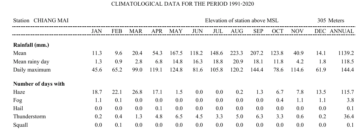
The Thai Meteorological Department (TMD) publishes climate normals for its Chiang Mai station, covering 1991-2020. TMD counts a rainy day as a day with 0.1 mm or more of rain.
| Month | Rain (mm) | Rainy days | Thunderstorm days |
|---|---|---|---|
| Jan | 11.3 | 1.3 | 0.2 |
| Feb | 9.6 | 0.9 | 0.4 |
| Mar | 20.4 | 2.8 | 1.3 |
| Apr | 54.3 | 6.8 | 4.8 |
| May | 167.5 | 14.8 | 6.5 |
| Jun | 118.2 | 16.3 | 4.5 |
| Jul | 148.6 | 18.8 | 3.3 |
| Aug | 223.3 | 20.9 | 5.0 |
| Sep | 207.2 | 18.1 | 6.3 |
| Oct | 123.8 | 11.8 | 3.3 |
| Nov | 40.9 | 4.2 | 0.6 |
| Dec | 14.1 | 1.8 | 0.2 |
The wet months run from May to October, and each averages 118.2 mm or more. The heaviest single day in the booklet is 144.4 mm, in September.
Haze runs the other way, with 26.8 days in March against 0.0 in June and July. For that season, see Chiang Mai burning season.
TMD announced in May 2025 that the rainy season would start on 15 May. Its outlook that year put the heaviest rain in August to October. It warned of one or two tropical storms that could bring flash floods and overflowing rivers.
What the 2024 floods hit
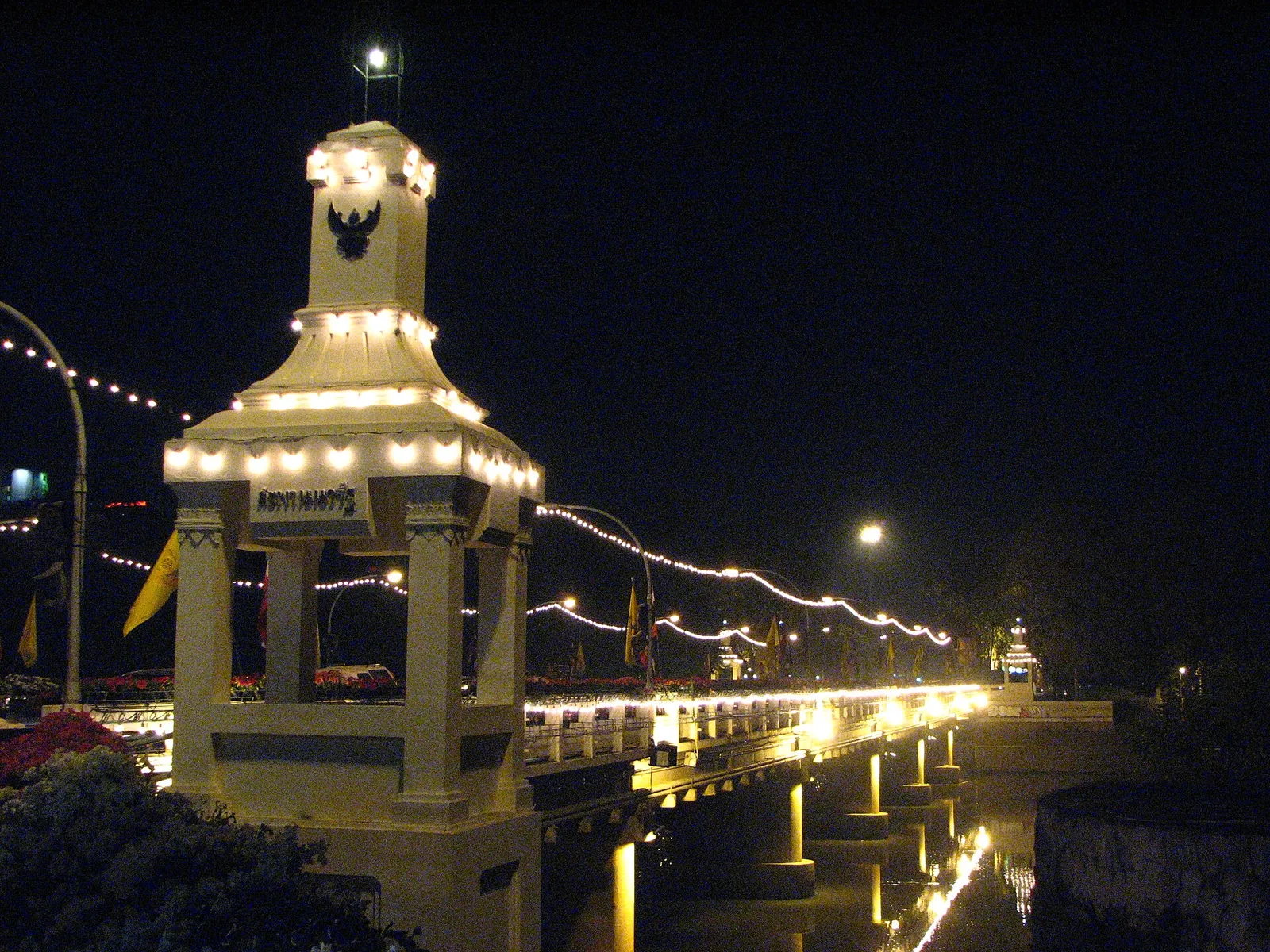
The first rise peaked at gauge P.1, Nawarat Bridge, at +4.93 m on 26 September 2024 at 02.00, which was 1.23 m above the bank.
The second was higher. The river passed the first peak on 4 October with a record 5.12 m. On 5 October at 08.00 the municipality reported 5.28 m, in the red critical range.
Thai PBS called it the second round that year in the economic area. It said water stood 1 m deep in many areas, a record for the past 50 years.
The Chang Khlan Road and Night Bazaar area was under more than 1 m of water, and some tourists were moved to safety.
Travel was hit as well:
- Flooding at the Arcade bus terminal left tourists stranded, because getting in and out was hard.
- Mahidol Road, the road to the airport, was flooded near Pa Phrao Nok.
- Water over the railway at Nong Hoi closed the line, because of the strong current. The state railway suspended service to Chiang Mai, and northern-line trains ended at Lampang.
- The airport was operating as usual on 5 October.
The irrigation office forecast that the level would recede to normal in about five days. The terminals and routes are covered in Chiang Mai bus and train stations and Chiang Mai airport to the city.
Which areas go under at which river level
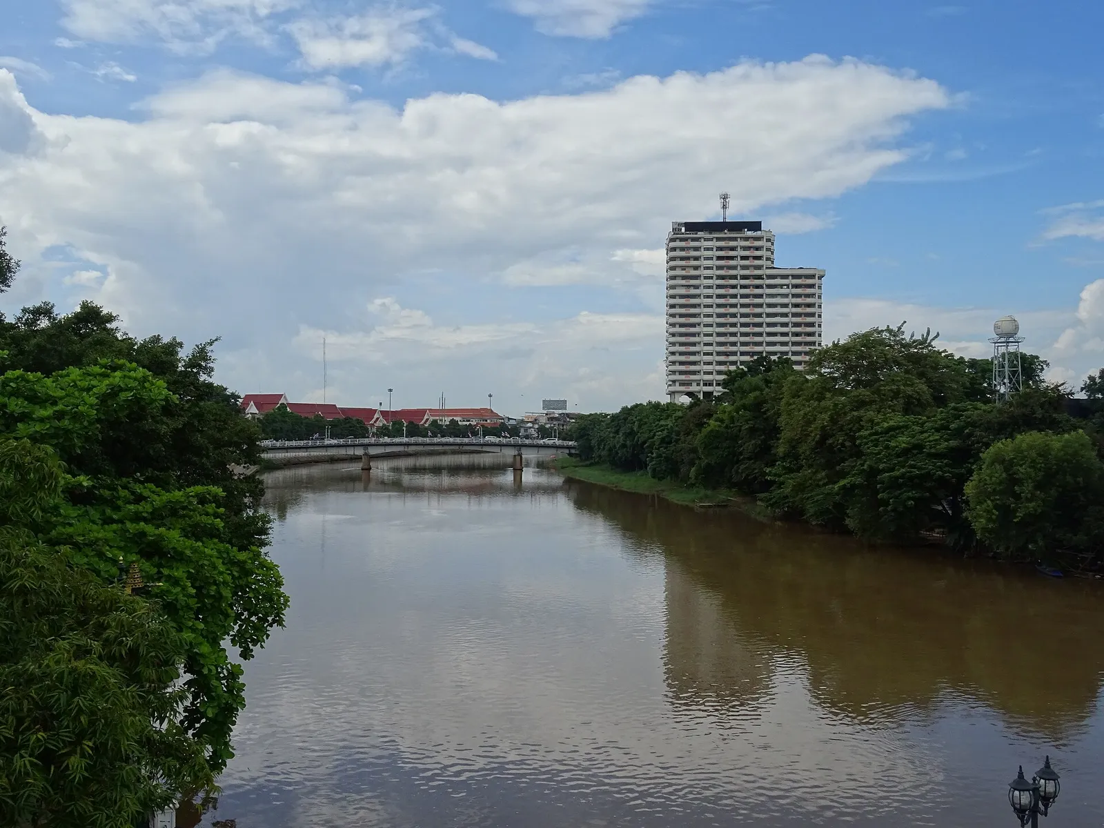
The Irrigation Office ties areas to the river level at Nawarat Bridge. On 25 September 2024 it reported 3.70 metres, a critical level.
Read the gauge at Nawarat Bridge and find your street in the zone table. Zone 1 starts at the +3.70 m critical level.
| Gauge level | Zone | Areas at risk |
|---|---|---|
| +3.70 m | 1 | Ban Pa Prao Nok (part), riverside restaurants, the underpass beneath Pa Daet Bridge |
| +3.90 m | 2 | Charoen Prathet Road, Chiang Mai Forestry, Montfort Primary School, Chai Mongkol Temple, Ban Pa Prao Nok, Wiang Thong Village |
| +4.00 m | 3 | Ban Den, the Provincial Electricity Authority (Ban Den), Jindanivet Village |
| +4.10 m | 4 | Rimping Supermarket, Tha Satoi Temple, Thong Kam Market, Kawila Camp, Kong Sai Road, San Pa Koi Market (part) |
| +4.20 m | 5 | Nong Hoi Market, Ko Klang Road, Montfort Secondary School, Kawila School, Muang Sat Luang and Muang Sat Noi temples, Palm Springs Village, Muang Kai Temple, Ratchadutis Road |
| +4.30 m | 6 | Chang Klan Road, the Night Bazaar, the Saeng Tawan intersection, Hua Fai Temple |
Move your belongings when the gauge reaches the zone that holds your street. The municipal flood barrier stands at +4.20 m.
On 27 September 2025 DDPM and Chiang Mai Province forecast 3.80 to 3.90 m, which is 0.30 to 0.40 m below that barrier. The same statement said the effect would fall on low areas outside the barrier in Mueang and Saraphi districts.
The governor named Pa Phrao Nok, Charoen Prathet and Chang Khlan as places where slight overflow was expected.
A 2022 Irrigation Office warning listed Railway Road and the railway station in its seventh area. That list gave no river level.
What to do before and during a flood
- Find your street in the zone table above.
- Lift belongings to high ground when a warning arrives.
- Prepare to evacuate if necessary, and move vulnerable people to safety first.
- Look after vulnerable groups in the building.
- Call 1784 for help; the DDPM hotline is open 24 hours.
People near a stream or waterfall should move away when warned. After a flash flood at Mae Sa Noi Waterfall on 5 October 2026, people in or near its waterway were told to move to a safe location.
Alerts and numbers to follow
- DDPM Cell Broadcast. Alerts sounded repeatedly in Chiang Mai ahead of Storm Bualoi in September 2025.
- Gauge data. Thaiwater.net is the national water-data portal. The Nawarat Bridge gauge is station P.1.
- DDPM hotline and LINE. Report an incident through the 1784 hotline or the LINE account with ID @1784DDPM.
- THAI DISASTER ALERT app. DDPM points people to it for warning announcements.
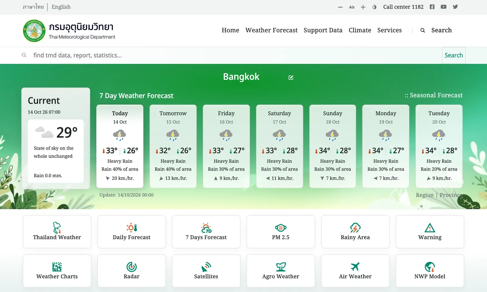
- TMD. Its English site has a 7 Day Weather Forecast, Warning and Weather Radar. The call centre is 1182.
Thunderstorms and continued rainfall were expected from 5–7 October 2026 after the Mae Sa Noi flash flood. Mae Sa Waterfall in Doi Suthep-Pui National Park was closed from 15 August 2026 after a flash flood, until conditions return to normal. Its current status is not confirmed here, so check that a waterfall is open before you go in the wet months.
Photo credits
- Nawarat Bridge over the Ping River at night: Wikimedia Commons, Nawarat Bridge 1 (opens in a new tab), Rinto Jiang (Public domain)
- The Ping River in Chiang Mai under a cloudy sky: Wikimedia Commons, Ping River in Chiang Mai 1 (opens in a new tab), Christophe95 (CC BY-SA 4.0)
- A stretch of the Ping River with a stone embankment: Wikimedia Commons, Ping River in Chiang Mai 4 (opens in a new tab), Christophe95 (CC BY-SA 4.0)
Step by step
- Compare your street with the zone listThe Irrigation Office ties six zones to river levels from +3.70 to +4.30 metres at Nawarat Bridge.
- Lift belongings when a warning comesDDPM asks people in risk areas to lift belongings to high ground.
- Be ready to leave and help vulnerable peopleDDPM asks people to prepare to evacuate if necessary and to move vulnerable groups to safety.
- Call the DDPM hotline for helpThe DDPM hotline on 1784 is open 24 hours.
Not confirmed: Flood map: no standing official flood-risk map was found. Check your street against the six-zone table, which comes from Irrigation Office warnings. Live gauge: Thaiwater.net is the national water-data portal, but its Nawarat Bridge gauge page was not confirmed, so follow DDPM and municipal updates.
Reach readers planning life in Chiang Mai. Advertise → hello@chiangmaijao.com
Common questions
When is the rainy season in Chiang Mai?
TMD's 1991-2020 normals show May to October with 118.2 mm of rain or more in each month. The year as a whole averages 118.5 rainy days.
Which month is the wettest in Chiang Mai?
August, with 223.3 mm of rain on average and 20.9 rainy days. September follows at 207.2 mm.
Has the Ping River flooded Chiang Mai city?
The Ping River passed its bank by 1.23 m at Nawarat Bridge on 26 September 2024. A second rise topped that: a record 5.12 m on 4 October and 5.28 m on 5 October.
What is the critical river level at Nawarat Bridge?
The Irrigation Office called 3.70 metres a critical level on 25 September 2024. Zone 1 areas such as the Pa Daet Bridge underpass are at risk from that level.
Which streets flood first?
Low areas outside the flood barrier in Mueang and Saraphi. Chang Klan Road and the Night Bazaar are at +4.30 metres.
Which number do I call in a flood?
DDPM runs a hotline on 1784, open 24 hours.
Will my phone get flood alerts?
DDPM Cell Broadcast alerts sounded in Chiang Mai in September 2025. DDPM also points people to the THAI DISASTER ALERT app.
Read next
General information checked against the sources listed above, not legal advice for your situation. Rules and office practice change; confirm with the immigration office or a licensed adviser before you act. See how guides are checked.
Spotted an error? Report it.